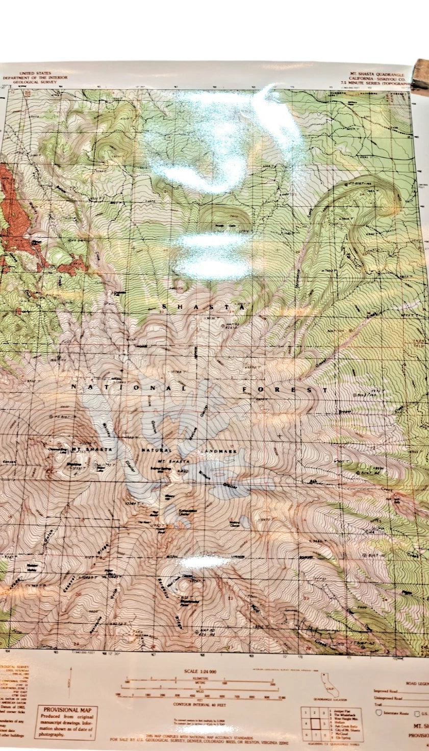
The product is a USGS Topographic Map of Mt. Shasta, California, from the Provisional Edition of 1986 at a scale of 1:24,000. This map shows detailed topographical features of the area, including elevations, contours, and geological information. Created by the United States Geological Survey, it serves as a valuable resource for mapping and cartography in the region. This particular map is a unique piece that captures the topography of Mt. Shasta in California from the 1980s, offering a glimpse into the past of the area's terrain and geography.